Saturday, August 1, 2009

Nevada and The Loneliest Highway

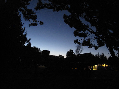
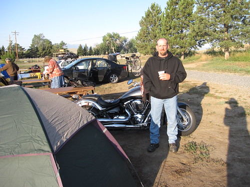
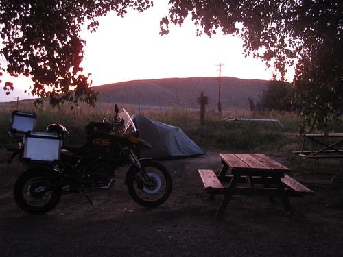
I always seem to get up early when I'm in a tent. Not sure if it's the restful sleep or the sunlight that does it...maybe both. Paul (on the Yellow Buell) and I were both up to help our fellow biker with his dead battery.

img_2740.jpg
img_2739.jpg

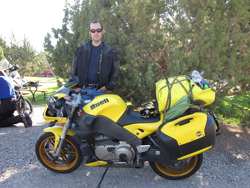
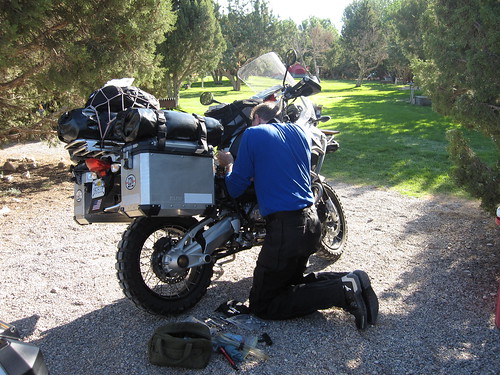
A jump didn't do it so we push started it, which also didn't work. And I tripped and fell on some huge rocks in the process...had I not been wearing my motorcycle gear, I would have been seriously hurt. Ouch. So I volunteered to go pick up a battery at the nearest auto parts store, Paul came with. Back a few min later, a new fully charged battery in hand, and we were on the road to get breakfast. I can't seem to recall his name at the moment, but he was really nice and bought us both breakfast for helping him out.

img_2742.jpg

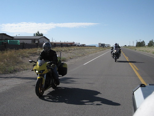
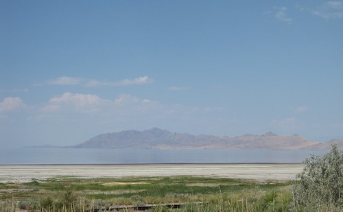
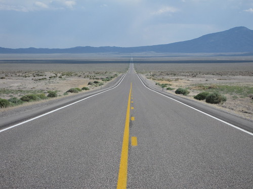
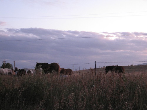
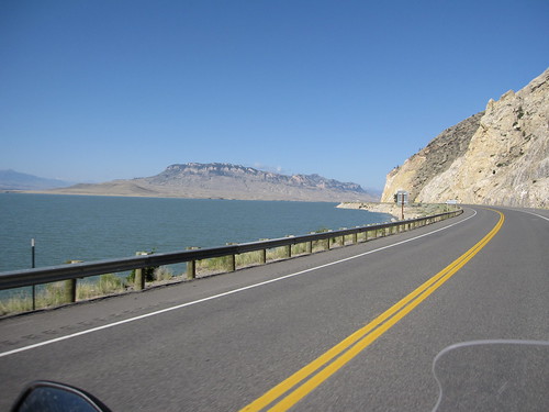
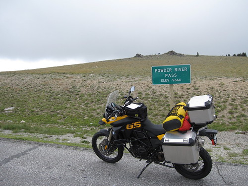
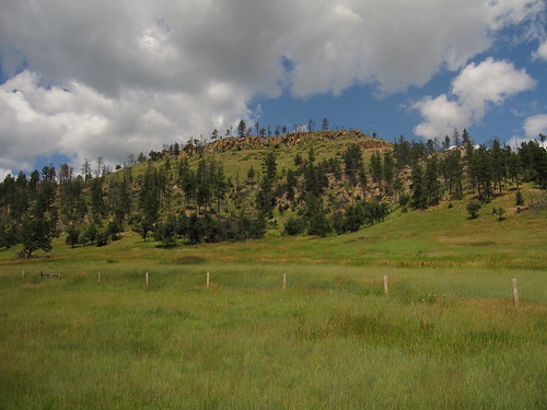
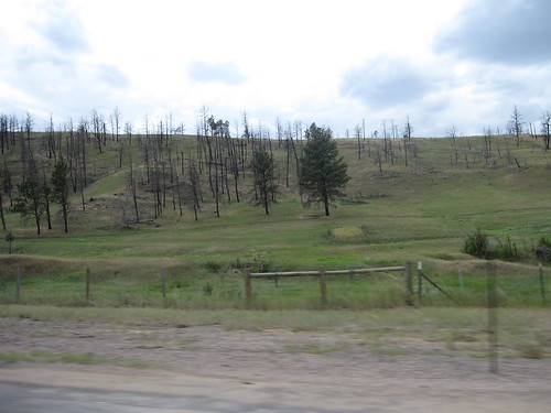
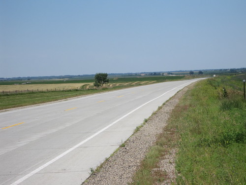
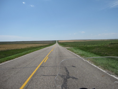
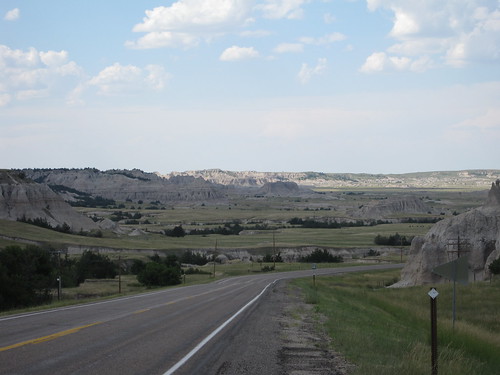
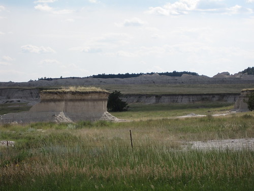
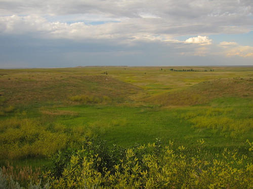
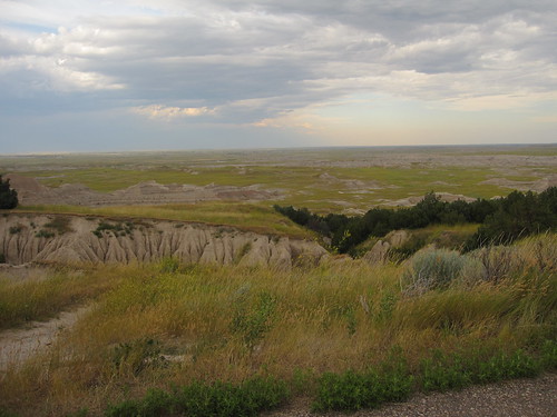
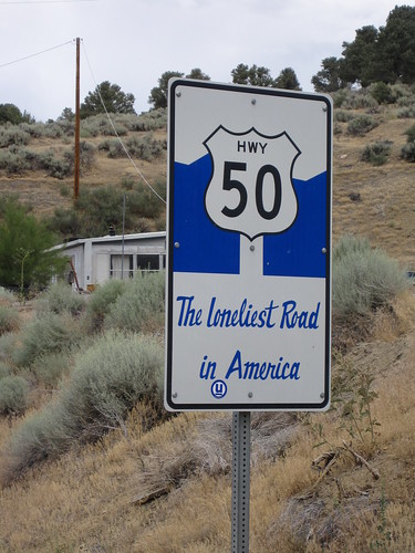
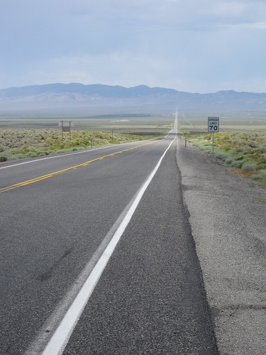
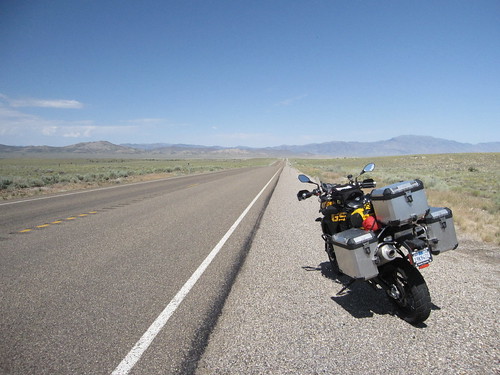
Highway 50 is similar to Hwy 93 that I had taken yesterday...straight and lonely. Except I think 50 has a better marketing department. It wasn't as lonely as 93, but the distance between towns (small ones!) and gas stations makes it a more lonely drive.


img_2761.jpg
img_2762.jpg


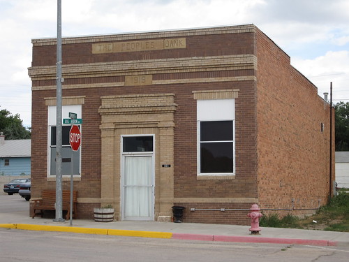
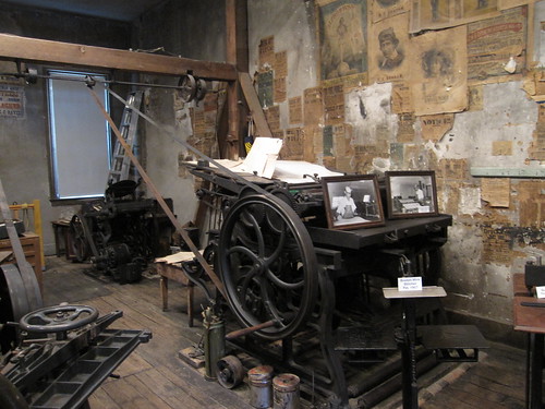
At the KOA the night before, one of the ladies at the desk had given me a Highway 50 survivors book...you go thru each town on the list and get a stamp and the Nevada Tourism Commission mails you a certificate. The first stop was Eureka, NV. I took a tour of the Eureka History Museum and got a shot of an old newspaper printing press. Even the modern versions of these are soon to be gone.

img_2754.jpg

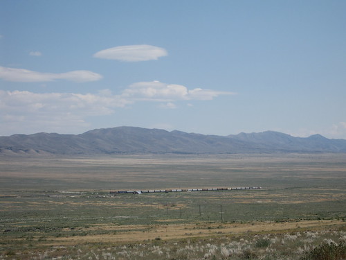
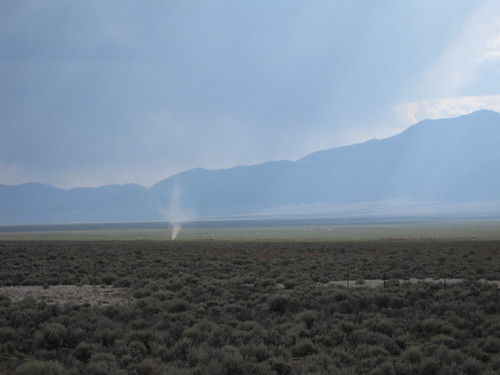
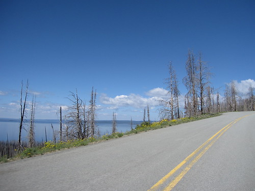
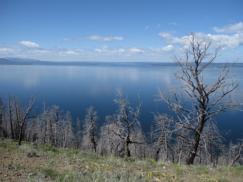
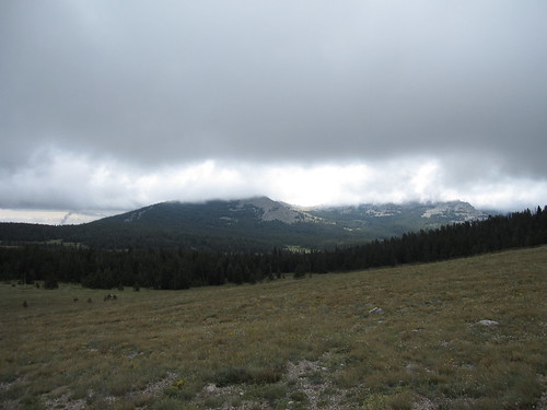
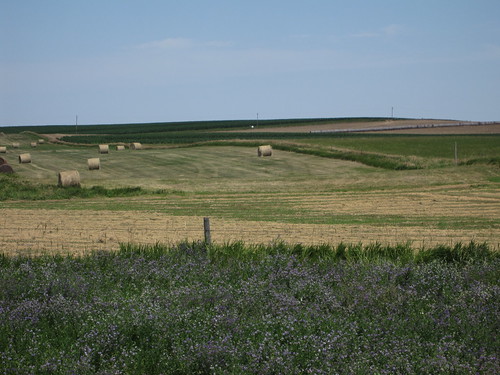
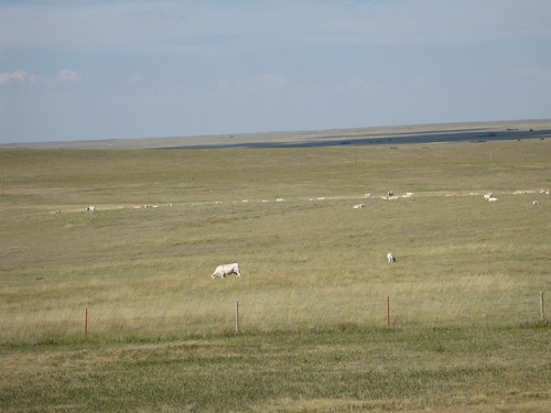
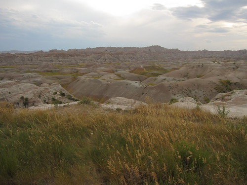
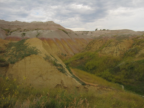
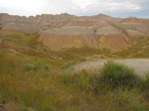
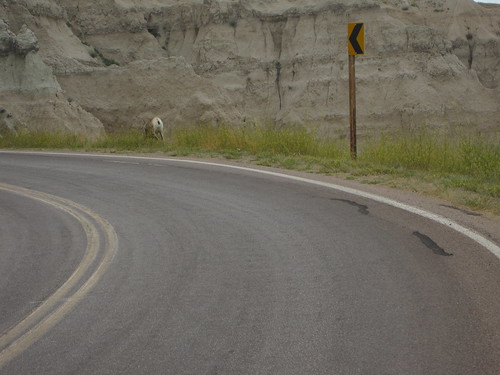
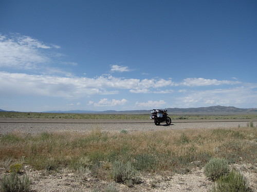
I didn't get much rain today, in fact, it was quite dry and hot. And boring. And when the antelope darted out in front of me as I passed a small hill, things got a lot more exciting. If I hadn't hit the brakes, I would have had antelope soup for lunch...or someone else would have had white boy soup with antelope on the side, or both. Catching my breath and needing a moment to calm down, I drove a little further and stopped for some pics.

img_2749.jpg
img_2753.jpg

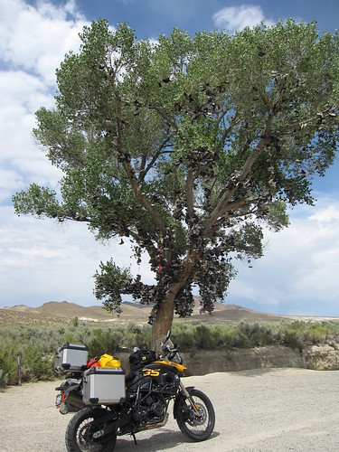
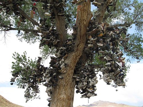
As I got closer to Fallon, NV and closer to the end of the lonely highway, I passed the Shoe Tree. Legend has it that quarreling lovers stopped by the road and one threw the other's shoes up in the tree. After they made up, the other reciprocated by tossing the first one's shoes up in the tree. And people have been doing it ever since. I grabbed a pair that had fallen and tossed them up. :)

img_2763.jpg
img_2767.jpg

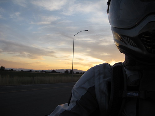
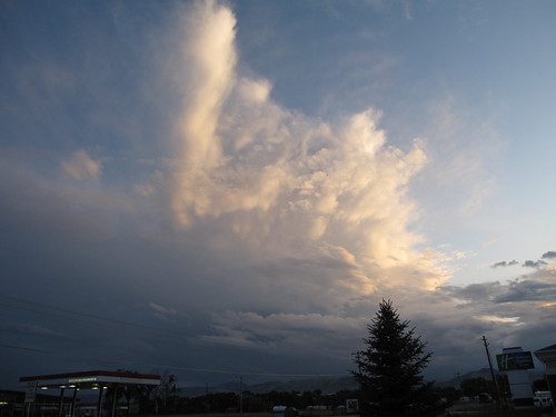
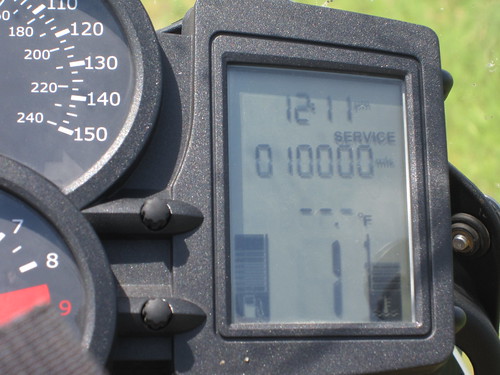
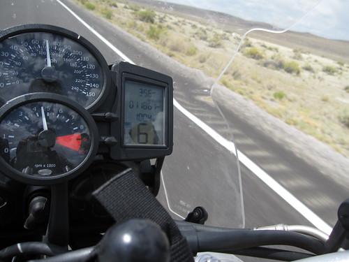
It was HOT at the end of the ride in the hills east of Fallon. I tried to snap a shot of the temp at 105 but by the time I got out my cam and focused it on the bike's temp gauge, I hit a pocket of cooler air that was 100.3. And of course as soon as I put it away, the temps go back up. Oh well.

img_2768.jpg

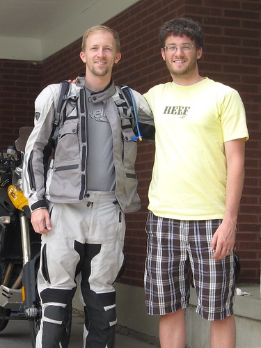
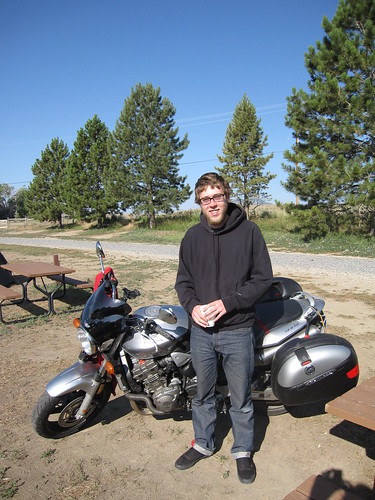
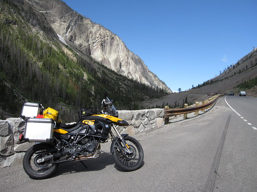
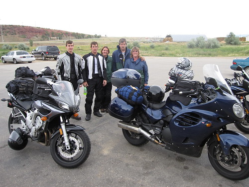
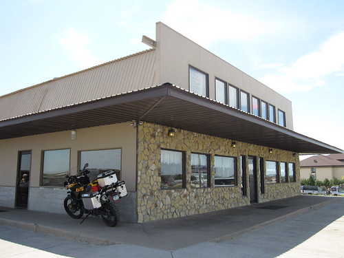
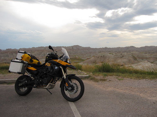
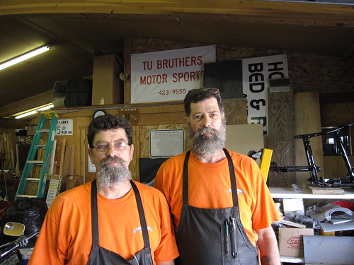
I stopped for some lunch at a 50's diner. I had been noticing a vibration in the bike so I looked up bike shops I could take it to for a look. Actually, I had noticed the un-even tire back in Ohio, but it looked small enough to get back to SD for a repair. But I felt it was getting significantly worse after the trip thru the hot desert. It was a Saturday, and few shops were open. I called up Tu-Bruthers Motorsports and even though they'd closed 5 min before I rang, they told me to come over anyway. The brothers looked at my bike and immediately found that my rear rim was bent. Over the thousands of miles on the trip, the bent rim wore the tire unevenly and it started to show after 8K miles. I hadn't hit any large potholes or anything that would have caused this on my trip so the brother's theory was that Cycle Gear bent it when they put on my current set of rubber. They deemed it not dangerous to my health to continue the rest of the way to San Diego, so after talking with them for a while about my trip and their shop, I got back to eating my lunch. The waitress at the diner had let me leave and come back an hour later, I tipped her well.

These guys were awesome, I can't recommend them enough.

img_2772.jpg

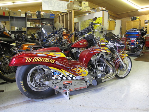
Their 360 HP race bike.

img_2775.jpg

I stayed the night in Fallon, NV at a hotel recommended by the Tu-Bruthers guys. A baseball tournament was in town so the hotel was packed full of obnoxious boys and even more annoying and obnoxious parents. I would have tried to camp but the nearest campsite I could find was an hour away, it was too hot and I was tired.

My route for the day, Highway 50.


View Larger Map

Tomorrow, into California and West to the coast!

Friday, July 31, 2009

Utah and the Bonneville Salt Flats

I had a restful stay in Salt Lake City at my buddy Josh's house. He took me out for burritos and ice-cream the night before, and his wife Natalie made me chocolate chip pancakes for breakfast, yummy. I slept in later than usual and then Josh and I went out for lunch. We stopped by his mom's house to see her awesome van, pictures describe it better than my words.

img_2682.jpg

Jerry Garcia's handprint.

img_2685.jpg

Josh and I just as I was about to head out.

img_2690.jpg

I hit the road on I-80 west. It was warm out, in the high 90's. After driving an hour or so, a rest stop provides a cool view of the famous Salt Lake. I had planned on going out for a swim, but I was told it stinks like hell, it's salty like brine and is HOT. I'm already hot, don't need more of that. So I got a nice pic. The reflection makes it look like the distant mountains are floating.

img_2692.jpg

The roads in North Western Utah are long and straight and provide for some beautiful scenery. Looks like some train cars just sitting there with no locomotive.

img_2695.jpg

As you come to the border of Utah and Nevada, just before Wendover, you encounter the Bonneville Salt Flats. Home to the Bonneville Speedway and holy ground to land-speed racers, speed freaks and gear heads. And something I've been dreaming of seeing ever since I got into things that go fast.

img_2696.jpg

It's 5-6 miles just to drive out to the salt.

img_2701.jpg

But when you get there, it's very worth seeing.

img_2704.jpg

There were signs posted all around that said "DO NOT DRIVE ON THE SALT, YOU MAY SINK"..or something like that. And cones that defined an area allowing you to get close-ish to the salt to take a pic. See when it rains, that place becomes a lake of muddy salt..in some spots up to 6 feet deep. So you can surely sink.

There were 3-4 cars and about a half dozen cruiser motorcycles all parked taking shots from the end of the access road where the signs were posted. Not good enough. I got off the bike and walked out onto the salt...as everybody looked at me like I was going to sink up to my waist at any moment. It seemed to be OK, and partly dry...only sunk in about 3/4 of an inch or so. So, I got back on my bike, fired it up, yelled "You only live once!" out loud into my helmet and sped off the concrete onto the salt. I'm sure the cars and cruisers were telling stories about how I wouldn't make it back. But it was fine, decently dry I thought. Slippery tho...I tried to get up some speed but didn't really feel comfy over about 50 mph or so...too squirrely, it felt like I was driving in mud. Guess it wasn't that dry. After driving out far enough not to be able to see the access road anymore (1-2 miles, I would guess), I got off the bike for a picture. And boy, it was worth it.


img_2713.jpg
img_2707.jpg


Think I'll have to get that first one framed. It's so flat you can actually see the curvature of the earth in the salt. Amazing. I tasted the salt...yep, super salty! Spent a few moments in awe, taking pictures and then headed out.

Stopped for gas in Wendover...that's when I noticed the salt. Everywhere. I walked from the pump over to the side of the station to kick it off my boots and noticed I left big salt foot prints. Oops. It was all over the bike too...I'd have to wash that off real soon.

img_2730.jpg

I headed back to the highway and on towards Nevada. The roads just go on forever, straight as an arrow. This is Hwy 93-A towards Hwy 93 towards Ely, NV.

img_2725.jpg

I drove thru 3 rain showers, but only one of them was enough to totally wet me. It was too hot to wear my rain gear but the cool rain felt good and it evaporated back to 100% dry in about 15 minutes in the dry Nevada air. I saw a couple dust-devils. They are sure cool to watch, just spin beautifully. I kinda wished one was on the road so I could drive thru it but I figured it'd knock me off the bike.

img_2728.jpg

I stayed at the KOA in Ely, NV that night. Very nice, they even let me wash the salt off my bike at the maintenance shed out back. I had to wash it twice!

They put me in an area next to a bunch of other motorcyclists. A group of guys on cruisers headed to Sturgis, and a few other adventure riders headed to various areas of the country. Paul, on a Buell, was headed to Florida via a similar route that I'd taken, just in reverse. One guy had a BMW with a dead battery...we philosophized about how to get him started in the morning and then headed off to sleep. The cruiser guys gave Paul and I the last of their pizza and fried chicken, which was super cool of them.

I slept pretty good that night, going to bed about 9PM. I woke up at 4AM to take this shot of Venus out the front of my tent.

img_2736.jpg

My route for the day, 247 miles.


View Larger Map

My destination for the day is Ely, NV...which you may know as the eastern starting point for HWY 50, the "Loneliest Highway in America".

Thursday, July 30, 2009

Yellowstone

I woke up after a restful night in the tent to the sound of horses being wrangled next to me. Some of the cowboys I'd seen the day before were rounding them up to be put in a trailer.

img_2590.jpg

Another motorcycle Adventurer named Mike stopped by to say hi as I was packing up. He is a photography student, traveling across the country taking pictures. Nice guy.

img_2594.jpg

After a breakfast of pancakes and bacon served up by the campsite staff, I headed out from Cody into the mountains and on my way to Yellowstone. The roads were beautiful and even included a few tunnels. Not sure what it is about tunnels that make them so fascinating.

img_2596.jpg
img_2599.jpg

The entrance to the park was blocked by dozens of RV's...but the single lane road splits into 10 entrance slots to pay your fee, and I found my way to the front of the line on the motorcycle. Hehe. Glad I bought the National Park Pass...that has more than paid for it's self.

After you get into the park, the roads get even better. The concentration of people is a lot higher, and the RV and mini-van quotient goes thru the roof. It makes for some slow motorcycling but if you can relax and let them get ahead of you, the views are worth it.

img_2604.jpg
img_2627.jpg

These two shots were taken from the spot furthest from any other road in the lower 48 (30 miles). It's also further from civilization as well, Jackson being the closest at 100 miles. Pretty amazing.

img_2630.jpg
img_2637.jpg

Continuing into the park, traffic got backed up...apparently a buffalo was standing in the road.

img_2640.jpg

I was kind of just passing thru the park...no real plans to stop and see anything other than what might catch my eye and a stop at Old Faithful. But boiling water coming out of the earth made me park and take a look. The colors were amazing...as was the smell. Peww, sulfur!

img_2648.jpg
img_2651.jpg
img_2650.jpg
img_2654.jpg

Continuing thru the park, the drive is just amazing. Crossed the Continental Divide a few times...for those that forget their 3rd grade science lessons, this is the dividing point at which water flows towards different major bodies of water. In the case of the Great Divide (pictured below), the Atlantic and Pacific. There are 4 major continental divides in North America, apparently I crossed 3 of them on this trip. Cool!

img_2658.jpg

As I got closer to Old Faithful, the traffic picked up. Lots of people...huge parking lots. Signs everywhere. Instead of following the flow of cars, I just jumped out of line and went right up to the closest rock-star parking possible. Which of course is all full...but all the motorcycles just park wherever so I parked mine in a sandy island within a stones throw of the main attraction.

Apparently Old Faithful was going off every 93 minutes...and I got there with 45 min to go. So I lined up on the benches like everybody else to watch.

img_2660.jpg

Ate a snack, chatted up a few people. Finally the moment came...it takes a while to get going. In the pic below, Old Faithful is in the center and other geysers are on the right and left. As it's preparing the big show, all the other Geysers go off around it. Kinda neat.

img_2664.jpg

Finally, right on time (take note NASA), thar she blows! I wish it wasn't so cloudy, it's hard to see the steam and water.

img_2673.jpg

After seeing Old Faithful, I exited the park on the West Entrance. Stopped for some food in West Yellowstone and realized I was in Montana. Too far away to see my buddy Scott but cool to be in the very bottom of the state anyway. I had many miles to go this day to make it to Utah where I had planned to stay with a friend...so I split for the highway. I didn't really want to take the highway but not much choice if I wanted to make up the time. I did SR20 from West Yellowstone out of Montana into Idaho Falls, the I-15 (yes the same I-15 I live a mile from down in SoCal) down to SLC. Here was my route for the day.


View Larger Map

The sun set on me as I drove thru south eastern Idaho. Very pretty. I thought of my friend Russ who lived a few hundred miles away in Boise. Sorry man, I'll have to visit you and Scott next trip.

img_2678.jpg


I arrived in SLC later than I wanted, around 9PM. My buddy Josh and his wife Natalie put me up in their house in Bountiful, UT in my own room, very nice.

Tomorrow, Nevada!

Wednesday, July 29, 2009

The Wild West

I left Buffalo, WY with some major wind and stormy weather on top of me. But I figured I had to get across the mountains somehow and there was no time like the present. It was 50 degrees at the base of the mountain, so I knew it'd be cold at the top. I put on all my winter gear and headed out. The ride up was beautiful. At one point I passed a sign that said something down the next road was 3 billion years old, so I took the road. Turns out I made a wrong turn and ended up on a muddy trail, but it was beautiful anyway. I kinda felt like a bear might get me.

img_2475.jpg

I think these might have been the super old rock outcroppings, not sure.

img_2476.jpg

Continuing up and into the clouds it got colder and colder. I crossed Powder River Pass at 9666 feet at 38 degrees F. Woo-whee it was cold.

img_2485.jpg

On the way down the west side of the pass, I was in the clouds for a while...just like riding in fog.

img_2487.jpg

Apparently a whole flock of sheep live up at that altitude. They must have some nice warm outfits to live up there all year.

img_2488.jpg

After hitting the 'basin' area on the west side on U.S. Highway 16, I came to Ten Sleep (population 317), named for its location 10 nights, or "sleeps," between major Indian camps. I stopped at Dirty Sally's Soda Shop. Ended up with a root-beer float, yum.

img_2493.jpg

I had intended to hit up Yellowstone today but the storm had delayed my departure that morning, so I decided to call it a night in Cody, WY (Named after Buffalo Bill Cody) and set up camp at the KOA outside of town. I like KOA's because I get a hot shower and usually meet some really cool people. I ran into Larry, a fellow biker and generally all round good guy.

img_2591.jpg

He was waiting for a buddy who's bike had broken down so we decided to go into town to see the Buffalo Bill Historical Center. They have the largest collection of American guns in the world, which Larry was really into, as a gun collector.

img_2498.jpg
img_2545.jpg

We found out from the staff at the museum that Cody has nightly gunfights in the summer, so we had to stay for that. Basically, some actors in cowboy dress wielding real guns with blanks perform a skit in which they end up shooting at each other. Pretty entertaining.

img_2580.jpg

After it was over, we got some food at Irmas Hotel, built by Buffalo Bill for his daughter.

On the way home, I noticed my headlight was burnt out, dang. And it was getting dark. Larry had to split so I was on my own and not really sure what to do. The BMW bike uses regular H7-12W bulbs so I should be able to get those from any auto-parts store. I went to the fire station nearby and asked them if they knew of any local stores, they said that across from the Super Walmart was an Oreilly's. So I quickly rode over there to find that it was 8:02 and they closed at 8:00. Dammit. On a hunch, I tried the Walmart for parts. Low and behold, Walmart stocked the H7 bulbs, rad. And I was also able to pick up some toothpaste, which I'd run out of that morning. In the checkout line, I ran into a familiar cowpoke from the gunfights earlier.

img_2586.jpg

His name is Marc and he owns a motorcycle rental business in Wyoming, CC Rider Cycle Tours. We talked for a while about travel, why the layers of clothing the old cowboys used to wear kept you cool and life in general. What a cool guy.

Bedded down that night to the sound of horses behind me, about 10 feet away from my tent. After seeing all the Buffalo Bill and cowboy stuff, a gunfight, eating at Irma's and sleeping next to horses, I felt like I got a pretty good dose of the wild west.

img_2588.jpg

My route for the day.

View Larger Map

Tomorrow, on to Yellowstone!

Tuesday, July 28, 2009

Wyoming and Devils Tower

The drive from Spearfish towards Devils Tower is really pretty. Lots of rocky farmland.

img_2411.jpg

I saw lots of deer in the fields, but luckily none of them ran in front of me. I finally came around a mountain pass and saw the tower. Man it's massive. This is from more than 20 minutes away.

img_2417.jpg

And right outside the gates.

img_2424.jpg

There are many legends as to how it was created. My favorite is the one where magma from the earths crust started to come up to the top and was plugged. Then over hundreds of thousands of years, as the collision of the earths crust pushed the old sea-floor to the top, the soft limestone sediments around the magma plug were washed away by the weather, creating the tower. ;)

img_2439.jpg

The close up detail is really interesting.

img_2433.jpg

I think this is the most camouflaged I've been in my moto gear. Where's Waldo?

img_2437.jpg

There was a field next to the tower that is occupied by Prairie Dogs.

img_2446.jpg

The terrain in this part of Wyoming sure is interesting.

img_2460.jpg

I stopped in a "Whistle Stop" town named Moorcroft. Good food and friendly people. The town only had 500 residents and the Mayor even stopped in to say hi to my waitress. I really like the small towns. Check out this tiny bank.

img_2462.jpg

At a gas stop, I met a family of motorcycle travelers. So cool that they all ride, mom & dad, 2 brothers and sister.

img_2465.jpg

I stayed the night in Buffalo, WY and watched yet another big storm brew off to the East. I had originally planned on riding over the mountain pass but the storm and nightfall made that a bad idea. Plus it was below 30 up there. Yikes.

img_2469.jpg

My route for the day.


View Larger Map

Monday, July 27, 2009

Minuteman Missiles, Rushmore and Crazy Horse

Woke up in Wall, SD with plans to see some rockets. There were lots of storms in the area so I decided to go see the Minuteman Missile Site just east of Wall. I drove 30 minutes east (the wrong way) to get there at 9AM, but the tour was full. Doh. So I went out to the sites myself to see what I could see. Pretty cool, even without a guide.

img_2294.jpg
img_2292.jpg

The hardened security vehicle they drove around in.

img_2296.jpg

And a bomb-proof UHF antenna. Made by Collins, for Boeing. Neat! There was a ranger at the site, answering questions and giving history lessons. He let me know that if I couldn't get on the tour today, that the Air Force base an hour or so west had a silo you could actually go down inside. Cool!

img_2284.jpg

I went to the launch control facility too, to get a cool pic.

img_2304.jpg

Continuing west, I stopped by Ellsworth Air Force Base and took a tour of the base and the South Dakota Air and Space museum. The base tour included a trip down inside a Minuteman Missile silo built for training. So I got more missile shots and a few cool planes.

img_2313.jpgt
img_2328.jpg
img_2341.jpg

At one point, while heading towards some cool roads, I passed this factory with a logo I had to grab a pic of. Hehe.

img_2360.jpg

I headed towards Mt. Rushmore and Crazy Horse. A big storm had been brewing all day and I had the fortune of avoiding it thus far, but that luck ran out. I got hit hard by the storm. I had put in my waterproof liner so I was good. But the bike didn't like the rain. Same problem as Jamestown. It stalled out in the hard rain. It happened right after a deer had run out in front of me and I had slammed on the brakes...then it stalled out. So I sat on the side of the road getting rained on while huge trucks blasted me with water. After a while, it started fine and I continued on my way. Annoying.

img_2367.jpg

I stopped by the Crazy Horse Memorial first. I didn't realize how big it really is...they have been carving this since 1948 and it's not even near completion. When done, it will be the worlds largest statue. Amazing.

Here it is today.

img_2377.jpg

And this is the goal.

img_2380.jpg

Next, I hit up Mt. Rushmore. And got more rain on the way. The drive up there is really nice, you start to see large rock formations poking out of the terrain. Despite the rain, there were a lot of people there.

img_2388.jpg
img_2392.jpg

Mt. Rushmore is something Tracy and I always talked about doing, so I just snapped a few pics and left, didn't really stay for the hike, tour or any of the other stuff. Wasn't really wearing the right clothing anyway, and it was sprinkling rain still. Time to head out. I'll be back one day with Tracy and can do it right.

My route for the day.

View Larger Map

Tomorrow, Devils tower and on towards Yellowstone!

Sunday, July 26, 2009

South Dakota and the Badlands!

Headed out of my motel in Vermillion, I made tracks into South Dakota. First neat thing I came across was Fort Randall Dam. It's 2 miles long and one of the biggest in the world. Cost $200M for the Army Core of Engineers to build and generates $30M in electrical power revenue. They had a cool museum that I stopped at for a few moments for a bathroom/stretch break. They had some cool fossils in there...apparently the largest Sea Turtle fossil in the world was found here (but located in Souix City).

img_2192.jpg
img_2196.jpg

Eastern South Dakota is pretty..lots of rolling small hills interspersed between open flat areas. Lots of cows and crops.

img_2202.jpg
img_2203.jpg

My bike rolled over 10K too. Cool!

img_2199.jpg

I stopped for lunch in Winner, SD and ate at the Holiday House. Everyone was real friendly, including the owner, Tony, who let me park my bike up next to the restaurant, out of the sun.

img_2206.jpg

I continued West on SR44, towards the Badlands. This took me thru some large Indian Reservations. The road was lonely, flat and straight. And HOT. I was seeing mid 90's the whole way. I also had a hard time getting high octane fuel, so I did the boost and mid-grade mix.

img_2207.jpg
img_2222.jpg

As I started getting near the Badlands, the scenery changed. Lots of weather-worn ruts created some neat looking landscape.

img_2210.jpg
img_2218.jpg

Finally made it into Badlands National Park. Since I had purchased a national parks pass, I didn't have to pay again to get in. I did the Badlands loop 240, which was stunning. I'll let the pics speak for themselves.

img_2228.jpg
img_2230.jpg
img_2242.jpg
img_2245.jpg
img_2253.jpg
img_2255.jpg
img_2256.jpg

I stopped at a turn-out at one point and ended up using the timer to take a pretty rad shot. Makes it look like I'm an astronaut exploring another planet.

img_2252.jpg

The colors in the dirt here trump the Painted Desert handily.

img_2263.jpg
img_2270.jpg
img_2272.jpg

Saw some road-side wildlife. I believe this was a ram. Some newbie in a RV slowly crept up on them and moved directly in my shot, so all I got was the rear-end. And of course, he scared them off as well.

img_2275.jpg

I ended up staying in a neat cabin in Wall, SD. I had been itching to camp but the weather forecast shows more severe thunderstorms, so I chose a cheap cabin just south of the I-90 in Wall, SD. It was really nice and comfy. Had some great local food in town too. Lots of bikers are around now...the closer I get to Sturgis and bike week, the higher the Harley rider concentration. Here is my route from today:


View Larger Map

Tomorrow, the Black Hills and Western South Dakota.